FIRST ALERT: Thursday brings widespread rain with a chance for a wintry mix
First Alert Weather Day for winter weather potential
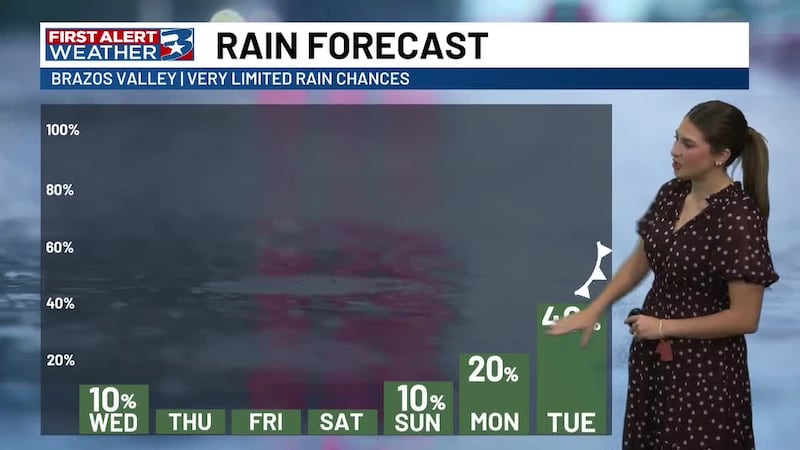
BRYAN, Texas (KBTX) - Arctic air is in place across the Brazos Valley, and while the week starts dry, moisture will return by midweek. This sets up the potential for quite a mess across the state from snow to rain to wintry mix. Let’s dive into what we can expect in the Brazos Valley.
THE SET UP
We have two areas of low pressure making this possible. The first is a powerful mid-level system that will develop over the southwest US by Tuesday. The second is a coastal low that will travel along the Texas coastline. This coastal system will start to spill moisture back into the skies, first as cloud cover on Wednesday.
WHEN WILL WE FIND PRECIPITATION?
While a stray shower is possible by midweek, the chance of rain is more likely to build into Thursday as Gulf and Pacific moisture collide. High resolution data has rain building in coverage through the overnight hours Wednesday and into early Thursday morning. Your morning drive on Thursday will likely be one where you want to give yourself a bit more time to get to where you need to go. Periodic rounds of rain will be possible throughout Thursday and coverage looks to clear into Friday.
WHAT WILL FALL?
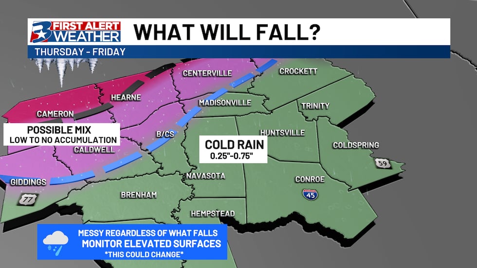
Heavy accumulating snow is likely from west Texas, stretching eastward towards the Red River and even through DFW. For most of us? Rain. A cold and messy rain, but just rain. That being said, the freezing line does look to be very close to our northern counties meaning that it is not impossible for a wintry mix to fall from time to time beginning as early as Wednesday night.
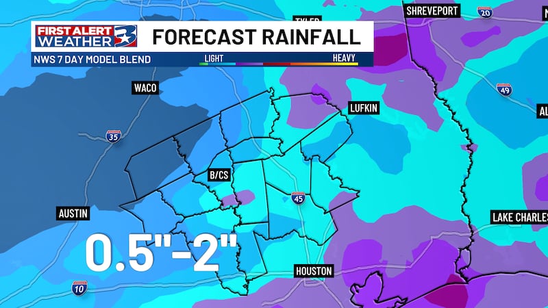
As of Monday morning, we are beginning to get higher resolution data confirming the set up described above and a look at accumulations. Finding any sort of wintry mix accumulating will be a hard ask. As for rainfall, anywhere from 0.25″-0.75″ will be possible.
While we do expect mostly rain to fall, it is important to remember that it will still be very cold with most of us falling to freezing or below Wednesday night and Thursday night. While not a guarantee, it will be possible to find some slick/icy spots on elevated surfaces, bridges, and overpasses. Those will need to be closely monitored, along with incoming data.
BOTTOM LINE
Thursday is a First Alert Weather Day for us to be aware of, not panic about. This is not a February 2021 scenario. Continue to stay tuned to the forecast in the coming days. THINGS WILL CHANGE as data continues to come into the First Alert Weather Center. Main roadways will not be an issue, but some elevated surfaces could become slick.
Copyright 2025 KBTX. All rights reserved.